2021.08.31

A mobile disaster preparedness map you can check anytime
いつでも見られる携帯版防災マップ -名古屋市防災アプリ-
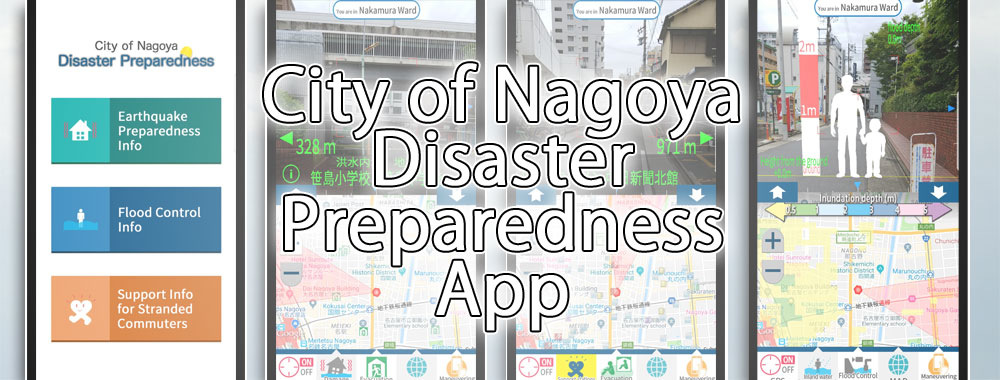
The City of Nagoya Disaster Preparedness App enables users to check disaster preparedness information related to earthquakes and flood damage for Nagoya City, and get information to assist commuters to walk home if public transport stops due to a disaster, using your smartphone or tablet. In addition to Japanese, the app supports English and Simplified Chinese (language displayed depends on your smartphone's language settings; some content displays in Japanese only).
As the app displays information including the estimated extent of damage and evacuation areas for your current location by superimposing it over the image from the device's camera, you can confirm visually the direction and distance of the facility you're looking for.
When you open the app, the upper half of the screen will display the image from the camera, while the bottom half shows a map, and information such as seismic intensity and damage forecasts including tsunami and flood inundation depth, along with information including evacuation resources, such as evacuation areas and tsunami evacuation buildings, are superimposed over the image.
And by downloading the map data beforehand, you can still use the map even when there is no network access during a disaster.
Because the map uses GPS, you can use the map on the move not only in an emergency, but also in emergency drills and to help familiarize yourself with emergency facilities around you.
Nobody knows when a disaster will occur. In your day-to-day life, familiarize yourself with the risks and evacuation areas in your neighborhood so that you can take action to protect yourself and those around you when an emergency arises.
Download the free app from the App Store or Google Play.


